
Satellite imagery is transforming the field of biblical archaeology, allowing us to uncover and study ancient sites in ways that were once unimaginable. With the advancements in technology and the use of high-resolution satellite images, we can now detect and analyze features that may not be visible on the ground. This has led to groundbreaking discoveries and a deeper understanding of our history.
Key Takeaways:
- Satellite imagery is revolutionizing biblical archaeology by providing a new way to uncover and study ancient sites.
- Advantages of satellite imagery in archaeology include the ability to survey large areas quickly and efficiently, track changes over time, and provide detailed information about the topography and features of the land.
- Major biblical discoveries, such as the possible location of the biblical city of Ziklag, have been enabled by satellite imagery.
- Challenges and limitations of satellite imagery include the interpretation of images and the potential obstruction of views by cloud cover or modern infrastructure.
- The future implications of satellite imagery in biblical site discoveries are promising, with advancements in technology and collaboration between experts.
Advantages of Satellite Imagery in Archaeology
Satellite imagery plays a crucial role in archaeological research, providing numerous advantages that have transformed the field. Let’s explore the key benefits of using satellite imagery in the detection and analysis of ancient sites.
Efficient Survey of Large Areas
One of the most significant advantages of satellite imagery in archaeology is its ability to survey large areas quickly and efficiently. By capturing high-resolution images from space, researchers can analyze vast stretches of land in a fraction of the time it would take using traditional ground-based surveys. This efficiency is particularly valuable when searching for potential ancient sites, as it allows archaeologists to cover extensive regions and identify areas of interest for further investigation.
Detailed Topographic Information
Satellite imagery provides detailed information about the topography and features of the land, enabling archaeologists to gain invaluable insights into ancient sites. The high-resolution images capture minute details, such as changes in terrain elevation, which can help identify potential burial mounds, ancient structures, or other hidden archaeological remains. This level of precision aids in pinpointing areas that warrant further examination, saving time and resources in the archaeological research process.
Tracking Changes Over Time
Another advantage of satellite imagery is its ability to track changes over time. By comparing satellite images taken at different intervals, archaeologists can monitor the effects of erosion, vegetation growth, or human activity on ancient structures. This longitudinal perspective allows for a better understanding of the site’s history and development, shedding light on how ancient civilizations interacted with their environment and providing valuable context for interpretation.
| Advantages of Satellite Imagery in Archaeology |
|---|
| Efficient survey of large areas |
| Detailed topographic information |
| Tracking changes over time |
*Note: This table summarizes the advantages of satellite imagery in archaeology.
Utilizing satellite imagery in archaeology brings undeniable benefits that enhance the discovery and analysis of ancient sites. The efficient survey of large areas, detailed topographic information, and the ability to track changes over time are all valuable tools that enable researchers to uncover and interpret the mysteries of the past.
Major Biblical Discoveries Enabled by Satellite Imagery
Satellite imagery has proven to be an invaluable tool in unearthing major biblical discoveries. Through the use of high-resolution satellite images, researchers have been able to identify and explore ancient sites that were previously hidden or unknown. This groundbreaking technology has provided a fresh perspective on biblical history, shedding light on the locations and structures mentioned in the Bible.
One significant discovery made possible by satellite imagery was the identification of the possible location of the biblical city of Ziklag. In 2017, researchers utilized satellite images to uncover a series of unique architectural features that aligned with the biblical description of the city. This finding added credibility to the existence of Ziklag and enhanced our understanding of King David’s encounters.
“The use of satellite imagery has transformed biblical archaeology, allowing us to explore ancient sites with unprecedented accuracy and detail. It has opened up new avenues of research and expanded our knowledge of the biblical world.”
Furthermore, satellite imagery has aided in the locating of ancient trade routes, confirming their existence as documented in biblical texts. By examining the landscape from above, researchers have been able to trace the paths of these routes and understand their significance in the economic and cultural exchanges of the ancient world.
Satellite imagery has also provided insights into potential sites of biblical miracles. By analyzing satellite images of the regions mentioned in biblical accounts, researchers have identified areas with geographical features that align with the descriptions of these miraculous events. This compelling evidence further supports the historical accuracy of the Bible.
Overall, the integration of satellite imagery into biblical archaeology has yielded remarkable discoveries and deepened our understanding of ancient biblical sites. Through the use of advanced technology and data analysis, researchers continue to unlock the secrets of the past and uncover new insights into the world described in the Bible.
Challenges and Limitations of Satellite Imagery in Archaeology
While satellite imagery has revolutionized archaeological research, it is not without its challenges and limitations. One of the main challenges is the interpretation of the images, as they can be complex and require expertise to decipher accurately. Archaeologists must exercise caution in drawing conclusions solely based on satellite data, as it may not provide the complete picture. The interpretation process involves analyzing various factors such as lighting conditions, image resolution, and image distortions that can impact the accuracy of the findings.
Ground-truthing, or conducting field surveys and excavations, is essential for verifying the findings from satellite imagery. It allows archaeologists to physically examine the site, collect additional data, and validate the initial observations made from the satellite images. This fieldwork is crucial for confirming the presence of ancient structures and understanding their context within the larger archaeological landscape.
Additionally, satellite imagery may face limitations due to external factors such as cloud cover and seasonal changes. Cloud cover can hinder the visibility of archaeological features, making it difficult to identify and analyze them accurately. Seasonal changes, such as vegetation growth, can also obscure the view of ancient structures, further complicating the interpretation process. To overcome these limitations, archaeologists often combine satellite imagery with other remote sensing techniques, such as LiDAR, to obtain a more comprehensive understanding of the archaeological landscape.
Another limitation of satellite imagery in archaeology is the presence of modern infrastructure that obstructs the view of ancient sites. Urban development, roads, and other modern structures can mask or alter the appearance of archaeological features, making them challenging to detect and interpret solely through satellite images. In such cases, archaeological fieldwork becomes even more crucial in uncovering and understanding these hidden ancient sites.
Despite these challenges and limitations, satellite imagery has proven to be a valuable tool in archaeological research, providing a bird’s-eye view of the landscapes and aiding in the identification of potential sites of interest.
Interpretational Issues
Interpreting satellite imagery in archaeology requires a combination of skill, experience, and knowledge. This process involves analyzing various visual cues, patterns, and context to make accurate inferences about the archaeological features. However, there can be interpretational issues that arise due to the inherent limitations of the imagery or the subjectivity involved in the analysis.
One of the interpretational issues is the reliance on visual cues alone, which can sometimes lead to misinterpretations or false positives. Certain geological or natural formations may resemble archaeological features, potentially resulting in erroneous conclusions. Archaeologists must carefully evaluate all available evidence, including historical records, ground truthing data, and other archaeological methods, to validate their interpretations and mitigate interpretational issues.
Moreover, the interpretation process can be influenced by unconscious biases or preconceived notions about the site or culture being studied. These biases can impact the analysis and potentially lead to misattributions or misinterpretations. To minimize interpretational issues, archaeologists employ rigorous methodologies and rely on peer review and collaboration to ensure the validity and accuracy of their findings.
In summary, while satellite imagery has greatly contributed to archaeological research, it is crucial to acknowledge and address the challenges, limitations, and interpretational issues associated with its use. By combining satellite imagery with fieldwork, employing rigorous methodologies, and embracing collaboration, archaeologists can leverage the power of satellite imagery while mitigating its inherent limitations.
| Challenges | Solutions |
|---|---|
| Interpretation complexity | Ground-truthing, interdisciplinary collaboration |
| Cloud cover and seasonal changes | Combining satellite imagery with other remote sensing techniques |
| Modern infrastructure obstructing views | Archaeological fieldwork for uncovering hidden sites |
Future Implications of Satellite Imagery in Biblical Site Discoveries
The future holds immense potential for biblical site discoveries as advancements in satellite imagery technology continue to revolutionize the field. Researchers are constantly developing new algorithms and techniques that enhance image analysis, enabling more accurate identification and mapping of ancient sites. These technological advancements open up new possibilities for uncovering and understanding biblical sites.
One of the significant developments in satellite imagery is the use of drones equipped with high-resolution cameras. These aerial vehicles allow for greater flexibility in remote sensing and provide detailed imagery of archaeological sites from different angles and perspectives. The combination of satellite imagery and drones offers archaeologists a comprehensive view of ancient sites, aiding in their interpretation and analysis.
With the aid of advanced image analysis algorithms, satellite imagery is instrumental in the identification of previously unknown ancient sites. By analyzing the patterns, shapes, and structures visible in satellite images, researchers can pinpoint potential archaeological sites that might have gone unnoticed during ground surveys. This targeted approach saves time and resources, allowing for more efficient archaeological investigations.
Furthermore, the use of satellite imagery in combination with Geographic Information Systems (GIS) allows archaeologists to create detailed maps and three-dimensional models of ancient sites. These digital reconstructions provide valuable insights into the layout, architecture, and organization of civilizations from the past. By virtually recreating these environments, researchers can gain a deeper understanding of ancient societies and how they interacted with their surroundings.
“Satellite imagery is a game-changer for biblical archaeology. It has accelerated our ability to discover and study ancient sites, leading to exciting new findings and shedding light on the rich history of the biblical world.” – Dr. Sarah Cohen, Archaeologist
The integration of satellite imagery and advanced technology in biblical site discoveries has far-reaching future implications for the field of archaeology. As image analysis algorithms continue to evolve, researchers will be able to detect smaller and more subtle features in satellite images, enhancing their ability to identify and interpret ancient sites. Additionally, the use of artificial intelligence and deep learning algorithms has the potential to automate the process of archaeological site identification, making it faster and more efficient.
| Advantages | Challenges |
|---|---|
| Survey large areas quickly and efficiently | Interpretation of images requires caution |
| Provide detailed information about topography and features | Cloud cover or seasonal changes can hinder image quality |
| Track changes over time | Modern infrastructure may obstruct the view of ancient structures |
Despite the challenges and limitations associated with satellite imagery, technological advancements continue to push the boundaries of archaeological research. The future holds immense potential for uncovering hidden secrets of biblical sites through the innovative use of satellite imagery and advanced analytics. With each new discovery, our understanding of history grows richer, providing valuable insights into the civilizations that came before us.

Collaboration between Satellite Imagery Experts and Archaeologists
The successful integration of satellite imagery in biblical site discoveries relies on collaboration between satellite imagery experts and archaeologists. This collaboration brings together the expertise and skills of two distinct disciplines, creating a powerful synergy that enhances the accuracy and scope of archaeological research.
Image analysts and remote sensing specialists work closely with archaeologists to interpret the satellite data and guide field surveys. By analyzing high-resolution satellite images, these experts can identify potential ancient sites, detect subtle features, and assess the landscape for archaeological significance. Their technical knowledge and understanding of satellite imaging techniques ensure that the data is accurately interpreted and relevant to archaeological investigations.
Archaeologists, on the other hand, provide valuable contextual insights and domain-specific knowledge to the collaboration. They possess a deep understanding of historical periods, cultures, and archaeological methods, which is essential for properly interpreting the satellite imagery findings. Archaeologists bring their expertise in excavation, documentation, and artifact analysis to validate and expand upon the initial discoveries made through satellite imagery.
“The collaboration between satellite imagery experts and archaeologists allows us to unlock the secrets of ancient civilizations and uncover hidden histories.”
– Dr. Sarah Thompson, Archaeologist
Bringing Together Expertise
This collaboration between satellite imagery experts and archaeologists facilitates the exchange of knowledge and expertise between different disciplines. Through ongoing communication and collaboration, satellite imagery experts gain a deeper understanding of archaeological goals and priorities, enabling them to refine and tailor their methods to specific archaeological contexts.
Conversely, archaeologists become familiar with the capabilities and limitations of satellite technology, empowering them to harness its potential effectively. This exchange of expertise leads to more comprehensive research outcomes, as both disciplines complement and build upon each other’s strengths.
Accurate Identification and Preservation
One of the crucial aspects of this collaboration is the accurate identification and preservation of ancient sites. By combining satellite imagery with archaeological field surveys, experts can confirm the presence of potential sites and determine their historical and cultural significance. This collaborative approach ensures that excavations and interventions are targeted and focused, preserving fragile archaeological remains for future study and appreciation.
Advancing the Field
Collaboration between satellite imagery experts and archaeologists is fundamental to advancing the field of biblical archaeology. As technological advancements continue to enhance satellite imaging capabilities, the collaboration becomes even more critical. By leveraging emerging technologies, such as artificial intelligence and machine learning, experts can streamline the analysis process, identify patterns and anomalies more effectively, and make even more significant discoveries.

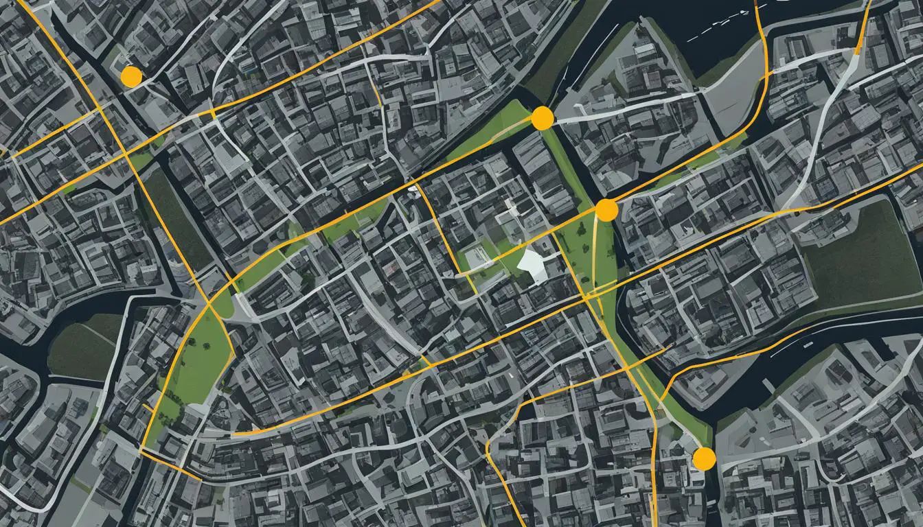
This image depicts the collaborative efforts between satellite imagery experts and archaeologists, showcasing the crucial role they play in uncovering and understanding biblical sites.
In conclusion, the successful integration of satellite imagery in biblical site discoveries relies on collaboration between satellite imagery experts and archaeologists. This partnership between different disciplines harnesses the power of advanced technology and archaeological expertise, leading to more accurate and comprehensive research outcomes. Through collaboration, we can continue to uncover the mysteries of ancient civilizations and gain deeper insights into our shared human history.
Conclusion
Satellite imagery has revolutionized the field of biblical archaeology, allowing researchers to make groundbreaking discoveries and gain a deeper understanding of ancient sites. The ability to survey large areas quickly and efficiently has led to significant archaeological breakthroughs, providing detailed information about the topography and features of the land.
Despite the challenges and limitations, ongoing advancements in technology and collaboration between experts are fueling further exciting discoveries in the future. Researchers are continually developing new algorithms and techniques to enhance image analysis, improving the accuracy of identifying and mapping biblical sites. The integration of drones equipped with high-resolution cameras is also expanding the possibilities of remote sensing in archaeology.
With each new discovery, satellite imagery continues to shed new light on history and deepen our understanding of biblical sites. It has become an invaluable tool in uncovering ancient mysteries, forever changing the way we study and perceive the past.
FAQ
How has satellite imagery revolutionized biblical site discoveries?
Satellite imagery has revolutionized biblical site discoveries by providing a new way to uncover and study ancient sites. It allows researchers to survey large areas quickly and efficiently, providing detailed information about the topography and features of the land. This technology has led to groundbreaking discoveries and a deeper understanding of history.
What are the advantages of satellite imagery in archaeology?
Satellite imagery offers several advantages in archaeological research. It allows researchers to survey large areas quickly and efficiently, which is especially useful for identifying potential ancient sites. The high-resolution images provide detailed information about the topography and features of the land, enabling archaeologists to pinpoint areas of interest. Additionally, satellite imagery can be used to track changes over time, such as the effects of erosion or human activity on ancient structures.
What major biblical discoveries have been enabled by satellite imagery?
Satellite imagery has played a significant role in several major biblical discoveries. For example, researchers have used satellite images to identify the possible locations of biblical cities, ancient trade routes mentioned in the Bible, and even potential sites of biblical miracles. This technology has led to significant archaeological breakthroughs and a deeper understanding of biblical history.
What are the challenges and limitations of satellite imagery in archaeology?
One of the main challenges is the interpretation of the images. Archaeologists must be cautious in drawing conclusions solely based on satellite data, as it may not provide the complete picture. Ground-truthing, or conducting field surveys and excavations, is essential to verify the findings from satellite imagery. Additionally, satellite imagery may be hindered by cloud cover, seasonal changes, or the presence of modern infrastructure that obstructs the view of ancient structures.
What are the future implications of satellite imagery in biblical site discoveries?
The future of biblical site discoveries is bright with advancements in satellite imagery technology. Researchers are continually developing new algorithms and techniques to enhance image analysis, allowing for more accurate identification and mapping of ancient sites. The use of drones equipped with high-resolution cameras is also expanding the possibilities of remote sensing in archaeology. These advancements will further revolutionize the uncovering and understanding of biblical sites.
How do satellite imagery experts collaborate with archaeologists?
The successful integration of satellite imagery in biblical site discoveries relies on collaboration between satellite imagery experts and archaeologists. Image analysts and remote sensing specialists work closely with archaeologists to interpret the satellite data and guide field surveys. This collaboration ensures the accurate identification and preservation of ancient sites and facilitates the exchange of knowledge and expertise between different disciplines.