
I am thrilled to explore the fascinating intersection of GIS applications and biblical archaeology in this article. The field of biblical archaeology relies on GIS technology to unlock historical and scriptural mysteries by analyzing and visualizing spatial data. With its ability to map ancient landscapes, aid in site selection and excavation planning, and analyze spatial relationships, GIS has revolutionized our understanding of the biblical world.
In this article, we will delve into the importance of GIS in biblical archaeology, the process of mapping ancient landscapes, the role of GIS in site selection and excavation planning, the power of visualizing archaeological data, and the value of analyzing spatial relationships and patterns. Through these lenses, we will gain a comprehensive understanding of how GIS applications have transformed the study of biblical archaeology.
Key Takeaways:
- GIS applications play a crucial role in biblical archaeology, enabling researchers to map ancient landscapes and decode historical mysteries.
- GIS helps archaeologists with site selection, excavation planning, and optimizing resources.
- Visualizing archaeological data using GIS enhances interpretation and facilitates communication.
- Spatial analysis with GIS reveals patterns and relationships in the ancient world, shedding light on past human behaviors and interactions.
- GIS technology continues to advance and will remain instrumental in uncovering historical and scriptural mysteries.
Importance of GIS in Biblical Archaeology
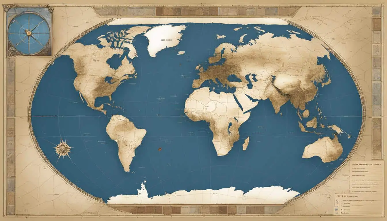
In biblical archaeology, Geographic Information System (GIS) technology plays a vital role in analyzing and managing immense amounts of spatial data. By integrating archaeological data with geographical information, GIS empowers researchers to uncover hidden patterns, relationships, and trends that may not be immediately apparent. With GIS, archaeologists can create accurate and detailed maps, conduct spatial analysis, and visualize the distribution of artifacts and features.
GIS enables biblical archaeologists to harness the power of spatial data to gain valuable insights into the ancient world. By leveraging GIS capabilities, researchers can:
- Create precise and comprehensive maps of archaeological sites and landscapes
- Analyze data to identify patterns and trends in the distribution of artifacts
- Visualize the spatial relationships between different elements of archaeological sites
- Conduct statistical analysis to uncover correlations and associations
Through GIS, biblical archaeologists can explore the spatial dimension of their research, shedding light on the intricate connections between people, places, and events described in the biblical texts.
“GIS technology provides us with a powerful framework for understanding the spatial context of biblical narratives. It allows us to combine historical data with geographic information, revealing fascinating insights into ancient civilizations and their interactions.”
By visualizing spatial data in GIS, archaeologists can communicate their findings more effectively and engage a wider audience in the wonders of biblical archaeology. The ability to create interactive maps, 3D models, and immersive visualizations brings the ancient world to life, making it easier for people to grasp the complexity and richness of biblical history.
Whether it is mapping the ancient landscapes, selecting excavation sites, or analyzing spatial relationships, GIS proves to be an indispensable tool for biblical archaeologists. Its ability to manage and analyze spatial data revolutionizes the way we explore and understand the mysteries of the biblical world.
| Benefits of GIS in Biblical Archaeology |
|---|
| Accurate and detailed mapping of archaeological sites |
| Identification of hidden patterns and relationships in artifact distribution |
| Visual representation of spatial connections within archaeological sites |
| Data-driven statistical analysis for deeper insights |
Mapping Ancient Landscapes
One of the most fascinating aspects of biblical archaeology is the ability to map ancient landscapes and reconstruct the environments in which historical events took place. Through the use of GIS mapping technology, researchers gain valuable insights into the natural features of the past, shedding light on the spatial context of biblical narratives and the location of potential archaeological sites.
GIS, or Geographic Information Systems, utilizes a combination of topographic data, geological formations, and satellite imagery to create detailed maps and visual representations of ancient landscapes. By analyzing these geographical elements, archaeologists can uncover hidden clues about the terrain, vegetation, and water sources that played a significant role in the lives of ancient civilizations.
“The ability to visually map out the ancient landscape allows us to better understand the environment in which biblical events occurred,” says Dr. Sarah Cohen, a renowned biblical archaeologist. “By examining the topography and natural resources of the past, we can gain a deeper appreciation for the challenges faced by ancient peoples and the impact these landscapes had on their daily lives.”
“GIS mapping gives us a unique perspective into the biblical world,” explains Dr. Cohen. “We can identify key geographic features mentioned in ancient texts and trace the movements of individuals and communities across the landscape. This information is invaluable in piecing together the puzzle of the past.”
For example, GIS mapping has been instrumental in identifying and tracing the routes of ancient trade networks, such as the Silk Road or the maritime trade routes of the Mediterranean. By analyzing the topography and geographical constraints of these landscapes, researchers can understand the challenges and opportunities that shaped ancient commerce.
The visual representation provided by GIS mapping allows archaeologists to highlight the connections between ancient settlements, trade routes, and natural resources, providing a comprehensive context for understanding the development and interaction of ancient civilizations.
Mapping Ancient Landscape in Action: Case Study of the Judean Desert
One notable example of GIS mapping in biblical archaeology is the study of the Judean Desert in Israel. Using GIS technology, researchers have reconstructed the ancient landscapes of this region, shedding light on the lives of ancient peoples such as the Essenes, who inhabited the famous Qumran caves.
The application of GIS mapping techniques allowed archaeologists to accurately visualize the topography and geological formations of the Judean Desert. By overlaying satellite imagery with historical data and archaeological findings, they were able to identify key features such as water sources, caravan routes, and potential hiding places, providing valuable insights into the daily lives and activities of the ancient inhabitants of the region.
In addition, GIS mapping enabled researchers to identify potentially undiscovered archaeological sites within the Judean Desert. By analyzing the spatial relationships between known sites and geographical features, archaeologists can target areas for further exploration and excavation, increasing the chances of unearthing valuable artifacts and historical evidence.
Benefits of GIS Mapping in Biblical Archaeology
| Benefits of GIS Mapping | Description |
|---|---|
| Accurate Visualization | GIS technology provides an accurate visual representation of ancient landscapes, allowing researchers to observe spatial relationships and patterns. |
| Identification of Key Features | GIS mapping helps identify important geographical features mentioned in ancient texts, providing insights into the natural resources available to ancient societies. |
| Site Selection | GIS aids in the identification of potential archaeological sites by analyzing the topography, proximity to water sources, and historical documentation. |
| Contextual Understanding | GIS mapping provides a comprehensive context for understanding the spatial aspects of biblical narratives and the movements of ancient peoples. |
| Targeted Excavation | By analyzing spatial relationships, GIS mapping guides the planning of excavation strategies, optimizing resources and increasing the chances of significant discoveries. |
Site Selection and Excavation Planning
When it comes to conducting archaeological excavations, the site selection process is crucial. Archaeologists need to identify areas with a high potential for yielding significant artifacts and evidence. This is where GIS applications play a vital role.
By leveraging GIS technology, archaeologists can incorporate various factors into their site selection process. These factors include topography, proximity to water sources, and historical documentation. GIS allows researchers to analyze and visualize these factors, helping them identify potential excavation sites that are more likely to provide valuable insights.
One of the key benefits of using GIS in site selection is its ability to integrate multiple layers of data. For example, archaeologists can overlay geological maps with historical records and satellite imagery. This integration of data allows researchers to identify areas that align with the characteristics of ancient settlements, reinforcing the likelihood of discovering important archaeological remains.
In addition, GIS enables archaeologists to plan their excavation strategies effectively. By visualizing the spatial data, researchers can optimize their resources and prioritize excavation areas with the highest potential for discoveries. This allows for a more efficient use of time, manpower, and equipment during the excavation process.
Mapping the Potential:
Let’s consider the case of a biblical archaeology project focused on uncovering ancient settlements in the region of Canaan. By utilizing GIS applications, the research team can assess various factors critical to site selection, such as terrain characteristics, proximity to water sources, and historical evidence of settlements.
“GIS technology has revolutionized our ability to narrow down potential excavation sites in biblical archaeology. By overlaying different data layers and analyzing spatial relationships, we can make more informed decisions about where to dig. This has significantly increased the chances of discovering valuable artifacts and shedding light on ancient civilizations.”
With GIS, the research team can identify areas with suitable topographic conditions, such as natural barriers, access to fertile land, or proximity to trade routes mentioned in historical sources. This initial assessment helps narrow down the search and prioritize areas for further investigation.
Furthermore, GIS technology allows for the integration of remote sensing data, such as aerial imagery or LiDAR scans, to identify potential archaeological features that may be hidden beneath the surface. By analyzing these remote sensing data sets, archaeologists can identify anomalies that indicate the presence of buried structures, ancient roads, or other significant archaeological remains.
Once the potential excavation sites have been identified using GIS, the research team can proceed with detailed surveys, ground truthing, and additional analysis to confirm the suitability of these sites. This thorough approach ensures that resources are allocated efficiently, maximizing the chances of making significant discoveries.
To summarize, GIS applications greatly facilitate the site selection and excavation planning process in biblical archaeology. By incorporating various data layers, analyzing spatial relationships, and visualizing potential excavation sites, GIS enables researchers to make more informed decisions about where to focus their efforts. As a result, archaeological expeditions can optimize their resources, increase the likelihood of significant discoveries, and contribute to a deeper understanding of ancient civilizations.

Visualizing Archaeological Data
When it comes to studying biblical archaeology, the visualization of archaeological data plays a crucial role. With the help of GIS technology, researchers are able to create interactive maps and 3D models that allow for a better understanding of excavation sites, artifacts, and features. This visual representation enables a more comprehensive interpretation of the data, leading to deeper insights and a clearer communication of research findings to a wider audience.
One of the key benefits of GIS visualization in biblical archaeology is the ability to bring the past to life. By creating detailed maps and models, researchers can explore the spatial relationships between different elements, such as the proximity of settlements to water sources or the distribution patterns of specific artifacts. This allows for a more holistic understanding of the ancient world and how people lived during biblical times.
Take, for example, the excavation of an ancient city mentioned in the Bible. By visualizing the archaeological data with GIS, researchers can create an interactive map that showcases the layout of the city, the location of important structures, and the movement of people within the city walls. This visualization not only aids in the interpretation of the data but also helps researchers identify potential areas for further exploration and excavation.
Another advantage of GIS visualization is its ability to facilitate collaboration among researchers. Through the creation of digital maps and models, scholars from different disciplines can come together to analyze and discuss the data. This interdisciplinary approach fosters a more comprehensive understanding of the archaeological sites and allows for a more nuanced interpretation of the findings.
GIS visualization in biblical archaeology allows us to see the past in a new light. By combining spatial data with advanced mapping techniques, we can uncover hidden patterns, reconstruct ancient landscapes, and gain valuable insights into the biblical world.
Preservation of Archaeological Data
Not only does GIS visualization aid in the interpretation of archaeological data, but it also plays a crucial role in its preservation. By creating digital records of excavation sites, artifacts, and features, researchers ensure that valuable data is accessible for future studies.
Traditionally, archaeological data was recorded on paper and stored in physical archives. However, these records are susceptible to damage, loss, or degradation over time. With GIS, researchers can create digital databases that store not only the textual information but also the spatial coordinates and visual representations of the data.
This digital preservation not only ensures the longevity of the data but also allows for easier dissemination and sharing. Scholars from around the world can access these digital archives and contribute to the collective knowledge of biblical archaeology.
Enhancing Research and Exploration
The use of GIS visualization in biblical archaeology has revolutionized the way researchers approach their work. By providing a visual representation of the data, GIS allows for a more holistic and contextual interpretation of the archaeological sites and artifacts.
Moreover, GIS visualization enhances the exploration of new archaeological sites. By overlaying spatial data, such as topography and historical documentation, researchers can identify potential areas for excavation with a higher likelihood of uncovering significant findings. This targeted approach optimizes resources and increases the chances of making important discoveries.
Overall, GIS visualization has become an indispensable tool in the field of biblical archaeology. Through the creation of interactive maps, 3D models, and digital archives, researchers are able to unlock the secrets of the past and share their findings with the world.

Advantages of GIS Visualization in Biblical Archaeology
| Advantages | Description |
|---|---|
| Improved interpretation | GIS visualization allows for a better understanding of excavation sites, artifacts, and features, leading to deeper insights and more accurate interpretations. |
| Collaboration and interdisciplinary research | GIS visualization facilitates collaboration among researchers from different disciplines, fostering a comprehensive understanding of archaeological sites. |
| Preservation of digital records | By creating digital archives, GIS helps in the long-term preservation of archaeological data, ensuring its accessibility for future studies. |
| Enhanced research and exploration | GIS visualization guides the exploration of new archaeological sites, increasing the chances of making important discoveries. |
Analyzing Spatial Relationships and Patterns
When it comes to understanding the ancient world and its societies, spatial analysis plays a vital role in biblical archaeology. Through the use of GIS technology, researchers are able to examine the relationships and patterns between archaeological sites, features, and artifacts, providing valuable insights into our past.
By utilizing geospatial tools and techniques, archaeologists can identify clustering, proximity, and distribution patterns, shedding light on the behaviors and interactions of ancient civilizations. Spatial analysis allows us to go beyond individual artifacts and sites, enabling us to piece together a more comprehensive understanding of our history.
One key aspect of spatial analysis is the identification of clustering, which helps us discover areas where significant archaeological discoveries have been made. By identifying patterns of artifact density, we can gain insight into the significance of certain regions and their role in ancient societies.
“Spatial analysis allows us to see beyond the surface and visualize how ancient civilizations interacted with their environment and with each other.”
Proximity analysis is another crucial component of spatial analysis. By examining the distances between archaeological sites, we can infer connections and travel patterns, providing us with a deeper understanding of trade routes, cultural exchange, and communication networks.
Furthermore, distribution pattern analysis allows us to investigate the spread of artifacts and features across a given area. This analysis aids in deciphering the spatial context of ancient events and the impact they had on various regions.
In combination, these spatial analysis techniques help archaeologists reconstruct the dynamics of past societies, unravel mysteries, and contribute to a more accurate interpretation of biblical narratives. GIS technology empowers us to conduct detailed spatial analysis, visualizing the interconnectedness of ancient civilizations and revealing the stories that lie beneath the surface.
Insights from Spatial Analysis in Biblical Archaeology
| Insight | Explanation |
|---|---|
| Trade Routes | Spatial analysis helps identify routes and hubs of trade, enhancing our knowledge of economic exchanges in biblical times. |
| Social Interactions | By examining clustering and proximity patterns, we can understand how ancient societies interacted and formed social networks. |
| Environmental Factors | Spatial analysis allows us to explore how natural features and resources influenced settlement patterns and agricultural practices. |
| City Planning | Through the study of distribution patterns, we obtain insights into the planning and development of ancient cities and their infrastructures. |
Conclusion
The field of biblical archaeology has been revolutionized by the applications of GIS technology. With its powerful mapping, analyzing, and visualizing capabilities, GIS has become an invaluable tool for researchers in unraveling the mysteries of the biblical world. Through the use of spatial data, GIS allows us to gain deeper insights into ancient landscapes, aiding in the identification and interpretation of archaeological sites.
GIS technology has played a significant role in facilitating site selection and excavation planning. By integrating various factors such as topography, proximity to water sources, and historical records, GIS helps archaeologists identify potential sites with higher chances of unearthing important artifacts and evidence. Additionally, the utilization of GIS in excavation planning optimizes resources and enables researchers to prioritize excavation areas efficiently.
One of the most remarkable aspects of GIS is its ability to visualize archaeological data in a spatial context. With interactive maps and 3D models, researchers can present their findings in a more engaging and accessible manner. This visualization not only aids in the interpretation of data but also ensures the preservation of digital records for future studies.
As technology continues to advance, GIS will undoubtedly play an even more crucial role in the field of biblical archaeology. By harnessing the power of GIS applications, we can continue to uncover the historical and scriptural mysteries of the biblical world, paving the way for a deeper understanding of our ancient past.
FAQ
What role does GIS play in the field of biblical archaeology?
GIS applications play a crucial role in the field of biblical archaeology by helping researchers map ancient landscapes and decode historical and scriptural mysteries. GIS technology aids in the identification and interpretation of archaeological sites, providing valuable insights into the ancient world.
How does GIS help researchers in biblical archaeology?
GIS provides a powerful tool for analyzing and managing spatial data in biblical archaeology. By integrating archaeological data with geographical information, GIS enables researchers to identify patterns, relationships, and trends. It allows for accurate mapping, spatial analysis, and visualization of artifact distribution.
How does GIS technology contribute to mapping ancient landscapes?
GIS technology allows researchers to analyze topographic data, geological formations, and satellite imagery to map ancient landscapes and reconstruct historical environments. This mapping helps archaeologists understand the spatial context of biblical narratives and locate potential archaeological sites.
In what ways does GIS assist in site selection and excavation planning?
GIS incorporates factors such as topography, proximity to water sources, and historical documentation to help archaeologists identify potential excavation sites with a higher likelihood of yielding important artifacts and evidence. It also aids in optimizing resources and prioritizing excavation areas.
How does GIS enable the visualization of archaeological data?
GIS allows for the creation of interactive maps and 3D models of excavation sites, artifacts, and features. This visual representation aids in the interpretation of data and facilitates the communication of research findings to a wider audience. Additionally, GIS helps in the preservation of digital records for future studies.
What is the importance of spatial analysis in biblical archaeology?
Through the use of geospatial tools and techniques, GIS enables archaeologists to conduct spatial analysis, examining the relationships and patterns between archaeological sites, features, and artifacts. This analysis provides insights into past human behaviors and interactions, contributing to a more comprehensive understanding of the ancient world.