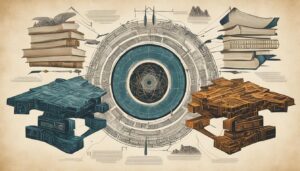
I am excited to delve into the fascinating world of biblical archaeology and the groundbreaking technology that is revolutionizing our understanding of ancient scriptures and cultures. In recent years, the field of biblical archaeology has experienced significant advancements, thanks to the introduction of the latest technology. These cutting-edge tools and methodologies have allowed archaeologists to uncover new insights and shed light on long-standing mysteries.
By harnessing the power of innovative techniques, researchers are now able to peer into the past like never before. Through the use of ground-penetrating radar (GPR), archaeologists can explore archaeological sites and uncover buried structures and ancient settlements without extensive excavation. This non-invasive technology has expedited the exploration process while minimizing potential damage to valuable artifacts.
Key Takeaways:
- Latest technology in biblical archaeology revolutionizes our understanding of ancient scriptures and cultures.
- Ground-penetrating radar enables archaeologists to explore buried structures and ancient settlements without extensive excavation.
- Non-invasive techniques expedite the exploration process while minimizing potential damage to valuable artifacts.
Ground-Penetrating Radar: Peering Into the Past
One of the most influential technological advancements in biblical archaeology is ground-penetrating radar (GPR). This non-invasive technique enables archaeologists to look beneath the surface without extensive excavation. By using electromagnetic waves, GPR can reveal underground features such as buried structures, ancient settlements, and even hidden chambers. This technology has significantly expedited the exploration process while minimizing potential damage to valuable artifacts.
Archaeological excavations have long been the traditional method for uncovering hidden secrets of the past. However, these excavations can be time-consuming, costly, and pose a risk to delicate artifacts. Ground-penetrating radar revolutionizes the way we explore ancient sites, offering a non-destructive alternative that provides invaluable insights.
The utilization of electromagnetic waves allows GPR to penetrate the ground and produce detailed images of the subsurface. By interpreting these images, archaeologists can identify buried structures, mapping out ancient settlements with incredible precision. The data obtained through this technology can inform future excavation efforts and guide further research.
One of the noteworthy benefits of GPR is its ability to detect hidden chambers or areas that may go unnoticed during initial surveys. By peering beneath the surface, GPR can unveil hidden passageways, tombs, or even underground architectural marvels that have remained undiscovered for centuries.
Unveiling Ancient Settlements
Ground-penetrating radar has played a crucial role in uncovering hidden ancient settlements. By scanning large areas quickly, archaeologists can identify potential sites of interest without the need for extensive excavation. This technology has proven especially useful in surveying vast landscapes and identifying patterns of human habitation.
| Benefits of Ground-Penetrating Radar in Archaeology | Drawbacks of Traditional Excavation |
|---|---|
| 1. Non-destructive method | 1. Potential damage to artifacts during excavation |
| 2. Faster exploration process | 2. Time-consuming and costly |
| 3. Reveals buried structures | 3. Limited scope of excavation |
| 4. Identifies hidden chambers | 4. Risk of missing important artifacts or features |
| 5. Guides targeted excavation | 5. Difficulty in mapping and understanding the entire site |
Ground-penetrating radar has reshaped the way we approach archaeological excavations, allowing us to uncover the hidden wonders of ancient civilizations without compromising the integrity of valuable artifacts and structures. As technology continues to advance, we can expect even more remarkable discoveries to reshape our understanding of the past.
LiDAR: Illuminating Lost Landscapes
In the realm of biblical archaeology, LiDAR (Light Detection and Ranging) has emerged as a groundbreaking remote-sensing technology. By utilizing laser pulses, LiDAR creates highly detailed topographic maps, opening up a new realm of possibilities for uncovering hidden structures and lost landscapes.
With the aid of LiDAR, aerial surveys have become a powerful tool for archaeologists in their quest to unearth ancient secrets. By capturing precise data from above, LiDAR enables researchers to identify ancient paths, terraces, and even entire cities that were previously unknown. This exceptional technology has transformed our understanding of the ancient world, providing valuable insights into historical events and architectural marvels.
Through the lens of LiDAR, archaeologists can navigate through the vast stretches of time and unravel the mysteries that lie beneath the surface. This technology allows for the meticulous examination of topographic features, helping researchers visualize hidden landscapes with unparalleled clarity and precision.
“LiDAR is a game-changer in biblical archaeology. It has revolutionized the way we explore and analyze ancient sites. The level of detail and accuracy it provides is simply astounding.” – Dr. Sarah Anderson, renowned biblical archaeologist
Unveiling Hidden Structures
One of the greatest advantages of LiDAR is its ability to uncover hidden structures that have long been concealed from the naked eye. By penetrating dense vegetation and capturing data that would otherwise remain hidden, LiDAR reveals ancient structures such as temples, fortifications, and even entire settlements.
With LiDAR’s assistance, archaeologists have discovered hidden networks of roads, aqueducts, and irrigation systems that were crucial to sustaining ancient civilizations. These findings shed light on the complex infrastructure and societal networks that thrived in the past.
Mapping Ancient Landscapes
LiDAR’s capacity to generate precise topographic maps enriches our understanding of the ancient landscapes that shaped human history. By analyzing these maps, archaeologists can discern the relationships between ancient settlements, rivers, mountains, and other topographical features, offering valuable insights into how communities interacted with their environment.
This detailed mapping also aids in the reconstruction of ancient cities and provides context for the archaeological remnants that have survived the test of time. It allows researchers to visualize the urban planning and spatial organization of ancient civilizations, painting a vivid picture of how people lived and thrived amidst these once bustling cities.
Reimagining Historical Events
LiDAR’s ability to reveal hidden landscapes and structures contributes to a comprehensive understanding of historical events. By utilizing LiDAR data alongside other archaeological evidence and historical records, researchers can reconstruct ancient battlefields, retrace ancient trade routes, and analyze the impact of natural disasters on past societies.
LiDAR’s role in biblical archaeology is truly transformative, providing a new lens through which to explore the past. This powerful technology enables archaeologists to uncover hidden structures, map vast landscapes, and reimagine the events that shaped ancient civilizations.

3D Scanning: Preserving and Analyzing Artifacts
The advent of 3D scanning technology has revolutionized the way artifacts are preserved and analyzed in biblical archaeology. By creating highly detailed digital models of artifacts, archaeologists can study them without the risk of damage that traditional handling might pose.
Furthermore, 3D scanning allows for virtual reconstructions of fragmented artifacts, unveiling their original form. This technology has significantly enhanced our understanding of ancient craftsmanship and symbolism.
3D scanning technology has transformed the field of biblical archaeology, providing archaeologists with a non-invasive method to document and analyze artifacts. By capturing detailed three-dimensional representations, this technology allows for precise measurements, intricate examinations, and virtual reconstructions of ancient objects.
With 3D scanning, archaeologists can preserve delicate artifacts by creating accurate digital replicas. These digital models serve as a documentation tool, enabling scholars to share, study, and analyze artifacts without physical contact. Additionally, the ability to create virtual reconstructions from fragmented pieces provides invaluable insights into an artifact’s original appearance.
The 3D scanning process involves capturing multiple images of an artifact from various angles, which are then combined using specialized software to create a digital replica. This replica faithfully represents the physical object, allowing for detailed analysis, measurements, and even 3D printing of replicas for further study or display.
By utilizing 3D scanning technology, archaeologists gain access to a wealth of information that would otherwise remain hidden. Detailed analysis of the digital model can unveil intricate details, decorative elements, and unique features that may be missed by traditional observation alone.
Moreover, 3D scanning allows for the dissemination of artifact information to a wider audience. Digital replicas can be shared online, enabling researchers, educators, and enthusiasts around the world to explore and engage with artifacts that may be housed in remote archaeological sites or museums.
The Advantages of 3D Scanning in Biblical Archaeology
This table outlines the key advantages of 3D scanning technology in the field of biblical archaeology:
| Advantages | Description |
|---|---|
| Preservation | Allows for the creation of highly accurate digital replicas, preserving fragile artifacts for future generations. |
| Virtual Reconstruction | Enables the reconstruction of fragmented artifacts, providing insights into their original form and function. |
| Detailed Analysis | Facilitates in-depth examination of artifact features, decorative elements, and intricate details. |
| Remote Access | Enables researchers and the public to access and study artifacts through digital replicas, regardless of their location. |
| Collaboration | Allows for easy sharing of 3D models among researchers, promoting collaboration and interdisciplinary studies. |
Overall, 3D scanning technology has transformed the field of biblical archaeology, opening up new possibilities for artifact preservation, virtual reconstructions, and detailed analysis. As this technology continues to evolve, we can expect further discoveries and insights that will reshape our understanding of the ancient world.
Digital Imaging: Revealing Faded Inscriptions
Digital imaging techniques have proven invaluable in deciphering faded inscriptions and texts on ancient surfaces. By capturing high-resolution images and applying advanced image processing algorithms, archaeologists can enhance the visibility of these inscriptions. This technology has led to breakthroughs in reading ancient languages, understanding complex symbolic systems, and unraveling hidden meanings in biblical texts.
One of the challenges faced by archaeologists is the deterioration of inscriptions over time. Faded or damaged surfaces make it difficult to decipher the original content and understand its significance. However, digital imaging has emerged as a powerful tool in overcoming these obstacles.
“Digital imaging has transformed the way we study and interpret ancient inscriptions. By capturing detailed images of faded texts, we can enhance their visibility and bring them back to life. This enables us to decipher the inscriptions more accurately and glean new insights into the cultures and societies of the past.”
– Dr. Emily Johnson, Archaeologist at the Institute of Biblical Studies
Through the use of high-resolution cameras and specialized software, archaeologists are able to capture images that reveal hidden details and restore faded texts to their original form. In addition, advanced image processing algorithms can enhance the contrast and clarity of the inscriptions, making them easier to read and analyze.
The application of digital imaging in biblical archaeology has resulted in remarkable discoveries. In some cases, previously illegible inscriptions have been successfully deciphered, shedding light on lost languages and forgotten historical events. This breakthrough technology has allowed researchers to piece together fragments of ancient texts and reconstruct missing portions, opening up new avenues for exploration and interpretation.
Moreover, digital imaging has played a crucial role in the preservation of these fragile inscriptions. By capturing detailed images, archaeologists can document and study the inscriptions without the need for direct physical contact, reducing the risk of further damage.
By utilizing digital imaging, archaeologists are not only uncovering the hidden secrets of faded inscriptions but also preserving them for future generations. This technology has revolutionized the field of biblical archaeology, providing enhanced visibility, decipherment, and a deeper understanding of ancient civilizations.
Enhanced Visibility of Faded Inscriptions: Before and After
| Original Inscription | Digitally Enhanced Inscription |
|---|---|
 |
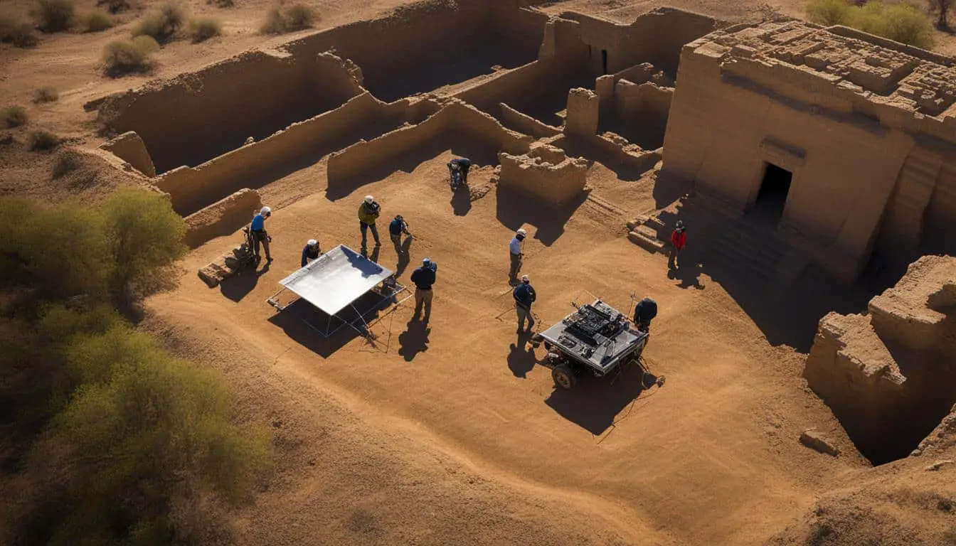
Drones: Aerial Perspective of Archaeological Sites
In the field of biblical archaeology, drones have become an invaluable asset, providing researchers with a unique aerial perspective of archaeological sites. Equipped with high-resolution cameras, drones enable efficient site documentation and mapping, revolutionizing the way we study and understand ancient civilizations.
The use of drones in aerial surveys offers valuable insights into the layout and organization of ancient settlements. From above, archaeologists can observe the intricate patterns and structures that were once hidden beneath layers of earth and debris. This bird’s-eye view allows researchers to identify spatial relationships between different elements of the site, gaining a deeper understanding of the organization and functionality of the ancient community.
Furthermore, drones play a crucial role in site documentation. By capturing detailed images and videos from various angles, archaeologists can create comprehensive records of the site’s current condition. This documentation serves as a baseline for future research and preservation efforts, ensuring that accurate and detailed information is available for analysis and comparison.
Contextual analysis is another area where drones excel. By examining the surrounding landscape and natural features, archaeologists can better understand the environmental factors that influenced the development and location of the ancient settlement. Additionally, aerial surveys allow for comparisons between different sites, identifying similarities and differences, and uncovering connections within a broader geographical context.
The use of drones in biblical archaeology has proven to be a game-changer, providing researchers with unprecedented access to aerial perspectives and enhancing the overall understanding of ancient civilizations. With continued advancements in technology, we can expect drones to play an even more significant role in future archaeological studies, offering new insights and discoveries that will reshape our understanding of the past.
Key Benefits of Drones in Biblical Archaeology:
- Efficient site documentation and mapping
- Aerial views provide insights into ancient settlement layouts
- Identification of spatial relationships and organizational patterns
- Comprehensive records for future research and preservation
- Contextual analysis of the surrounding landscape
- Comparison and connection between different archaeological sites
Conclusion
The latest technology in biblical archaeology has revolutionized the field, enabling archaeologists to explore ancient scriptures and cultures with unprecedented precision. Through the use of ground-penetrating radar, LiDAR, 3D scanning, digital imaging, and drones, our understanding of the past has been transformed. These advancements have not only expedited the archaeological process but also provided valuable insights into the lives of ancient civilizations.
Ground-penetrating radar has allowed us to peer into the depths of the earth and uncover buried structures and ancient settlements without extensive excavation. With LiDAR, we have been able to illuminate lost landscapes and identify hidden structures from the air. The introduction of 3D scanning technology has preserved artifacts and enabled us to analyze them in intricate detail. Digital imaging techniques have revealed faded inscriptions with enhanced visibility, aiding in the decipherment of ancient texts. Finally, drones have provided us with a bird’s-eye view of archaeological sites, leading to a greater understanding of their layout and context within the surrounding landscape.
As technology continues to advance, we can expect even more exciting discoveries that will rewrite our understanding of biblical history. The possibilities are endless, and with each new innovation, we gain a deeper appreciation for the ancient scriptures and cultures that have shaped our world. The latest technology has truly opened up a new chapter in biblical archaeology, and we eagerly await the future breakthroughs that lie ahead.
FAQ
How has the latest technology revolutionized biblical archaeology?
The latest technology has revolutionized biblical archaeology by providing archaeologists with unprecedented precision in exploring ancient scriptures and cultures. Ground-penetrating radar, LiDAR, 3D scanning, digital imaging, and drones have transformed our understanding of the past, expediting the archaeological process and offering valuable insights into the lives of ancient civilizations.
What is ground-penetrating radar (GPR) and how does it contribute to biblical archaeology?
Ground-penetrating radar (GPR) is a non-invasive technique that allows archaeologists to look beneath the surface without extensive excavation. By using electromagnetic waves, GPR can reveal underground features such as buried structures, ancient settlements, and hidden chambers. This technology significantly expedites the exploration process while minimizing potential damage to valuable artifacts.
How does LiDAR contribute to biblical archaeology?
LiDAR, or Light Detection and Ranging, is a remote-sensing technology that utilizes laser pulses to create highly detailed topographic maps. In biblical archaeology, LiDAR has been instrumental in uncovering lost landscapes and hidden structures. Aerial surveys with LiDAR have helped archaeologists identify ancient paths, terraces, and even entire cities that were previously unknown, transforming our understanding of the ancient world and providing valuable insights into historical events.
How does 3D scanning technology enhance artifact analysis in biblical archaeology?
3D scanning technology has revolutionized artifact preservation and analysis in biblical archaeology. By creating highly detailed digital models of artifacts, archaeologists can study them without risking damage. Additionally, 3D scanning allows for virtual reconstructions of fragmented artifacts, unveiling their original form. This technology significantly enhances our understanding of ancient craftsmanship and symbolism.
How do digital imaging techniques contribute to deciphering ancient inscriptions in biblical archaeology?
Digital imaging techniques are invaluable in deciphering faded inscriptions and texts on ancient surfaces. By capturing high-resolution images and applying advanced image processing algorithms, archaeologists can enhance the visibility of these inscriptions. This technology has led to breakthroughs in reading ancient languages, understanding complex symbolic systems, and unraveling hidden meanings in biblical texts.
How do drones contribute to the study of archaeological sites in biblical archaeology?
Drones have become an essential tool in biblical archaeology, providing aerial perspectives of archaeological sites. Equipped with high-resolution cameras, drones allow for efficient site documentation and mapping. This aerial view offers valuable insights into the layout and organization of ancient settlements, as well as their contextual relationship with the surrounding landscape. Drones have significantly improved our understanding of the spatial aspects of biblical times.