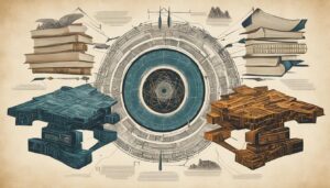
Remote sensing technology has transformed the field of biblical archaeology, revolutionizing our understanding of ancient history. Through the use of advanced techniques such as aerial photography, satellite imagery, LiDAR, and ground-penetrating radar, researchers can now detect and analyze archaeological remains with unprecedented accuracy.
By harnessing the power of remote sensing technology, we can uncover hidden archaeological sites, map out ancient structures, and gain deeper insights into the stories and events depicted in the Bible. Through the lens of remote sensing, we can trace the footsteps of our ancient ancestors and unravel the mysteries of our shared past.
- Remote sensing technology has revolutionized biblical archaeology, offering new perspectives on ancient history.
- Advanced techniques like aerial photography, satellite imagery, LiDAR, and ground-penetrating radar are used to detect and analyze archaeological remains.
- Remote sensing enables us to uncover hidden sites, map ancient structures, and gain deeper insights into biblical narratives.
- By utilizing remote sensing, we can expand our knowledge of ancient civilizations and enhance our understanding of biblical events.
- The future of remote sensing technology holds great promise for even more exciting discoveries in biblical archaeology.
The Applications of Remote Sensing in Biblical Archaeology
Remote sensing technology plays a crucial role in the detection and identification of archaeological sites related to the Bible. Through the use of aerial photography, satellite imagery, LiDAR, and ground-penetrating radar, archaeologists can unlock valuable insights into our ancient past. Let’s explore some of the key applications of remote sensing in biblical archaeology:
- Archaeological Site Detection: Aerial photography and satellite imagery are powerful tools for identifying subtle changes in vegetation or soil patterns that can indicate the presence of buried structures or ancient settlements. These images allow researchers to efficiently survey large areas and pinpoint potential excavation sites.
- Landscape Mapping: By combining remote sensing techniques, archaeologists can create detailed maps of ancient biblical landscapes. LiDAR, in particular, is highly effective in densely forested areas as it can penetrate through vegetation and generate highly accurate 3D maps of the underlying terrain. This helps researchers understand the topography and spatial relationships of ancient structures and features.
Remote sensing technology enables archaeologists to survey large areas, detect buried structures and artifacts, and create detailed maps of ancient landscapes in biblical archaeology. This enhances our understanding of the past and provides valuable context for interpreting biblical narratives.
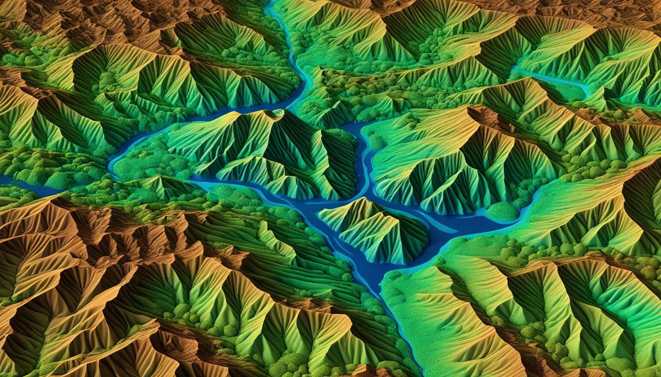
Here is an example of a LiDAR-generated 3D map that showcases the underlying terrain of an ancient biblical landscape:
As you can see, this map provides a visually stunning representation of the terrain, allowing archaeologists to visualize and analyze the ancient landscape in greater detail.
With the advancements in remote sensing technology, researchers are able to uncover hidden archaeological sites, accurately map ancient landscapes, and gain deeper insights into the biblical past. By leveraging the capabilities of aerial photography, satellite imagery, LiDAR, and ground-penetrating radar, remote sensing has become an invaluable tool in biblical archaeology.
Discovering Hidden Biblical Sites with Remote Sensing
Remote sensing technology has revolutionized the field of biblical archaeology, allowing researchers to uncover hidden biblical sites that were previously unknown or inaccessible. Through the use of remote sensing techniques, such as aerial surveys, satellite imagery, and LiDAR, researchers have made remarkable archaeological discoveries that shed light on ancient biblical narratives.
A prime example of the power of remote sensing technology is the discovery of ancient cities like Jericho and Megiddo. By utilizing aerial surveys and satellite imagery, researchers were able to reveal the existence of these cities, providing valuable insights into biblical history and supporting the accuracy of biblical narratives.
“Remote sensing technology has allowed us to peer into the past and uncover the hidden stories of the Bible. It has given us the ability to see ancient cities and landscapes with newfound clarity, enriching our understanding of the biblical world.”
LiDAR surveys have also played a pivotal role in uncovering hidden structures and pathways within biblical landscapes. By using a laser scanning technique, researchers have been able to reveal ancient road networks, water management systems, and other hidden features, offering a glimpse into the daily lives of people in biblical times.
These archaeological discoveries not only serve to enrich our understanding of the Bible but also contribute to the preservation and conservation of these important historical sites. Remote sensing technology allows researchers to identify and protect these hidden biblical sites, ensuring their long-term survival for future generations.
Hidden Biblical Sites Discovered with Remote Sensing
| Site | Location | Remote Sensing Technique | Main Discovery |
|---|---|---|---|
| Jericho | West Bank | Aerial Surveys, Satellite Imagery | Existence of ancient city |
| Megiddo | Israel | Aerial Surveys, Satellite Imagery | Existence of ancient city and fortifications |
| Qumran | West Bank | Aerial Surveys, Satellite Imagery | Presence of ancient settlement and Dead Sea Scrolls |
| Bethsaida | Israel | LiDAR Surveys | Revealed hidden road networks and urban structures |
| Hebron | West Bank | Aerial Surveys, Satellite Imagery | Identification of ancient city and tombs |
The use of remote sensing technology in biblical archaeology continues to unlock the secrets of the past, providing valuable insights into biblical narratives and contributing to our overall understanding of ancient civilizations. By harnessing the power of remote sensing techniques, researchers are able to discover hidden biblical sites that have remained concealed for centuries, ultimately deepening our appreciation for the historical and cultural significance of the Bible.
Mapping Ancient Biblical Landscapes
Remote sensing technology plays a crucial role in mapping ancient biblical landscapes, allowing researchers to reconstruct the environments in which biblical events took place. Through the analysis of satellite imagery and aerial photographs, we can identify natural features mentioned in biblical texts, such as rivers, mountains, and deserts. This detailed mapping provides valuable context for interpreting biblical narratives and understanding the interactions between humans and their environment in biblical times.
Landscape mapping using remote sensing technology goes beyond surface-level analysis. LiDAR surveys, for example, can reveal hidden topographic features that contribute to our understanding of ancient civilizations. Ancient terraces, fortifications, and agricultural systems become visible, offering insights into the agricultural practices of the past.
By creating detailed landscape maps, we gain a deeper understanding of the geographical and topographical elements that shaped biblical events. These maps help us visualize the settings of stories, allowing us to immerse ourselves in the biblical landscapes and gain a more vivid understanding of their significance.
The Importance of Remote Sensing in Landscape Mapping
“Remote sensing technology enables us to uncover hidden features and reconstruct the landscapes of the past, providing a tangible link to biblical narratives and enriching our comprehension of historical events.”
Example: Biblical Landscape Mapping
To illustrate the power of remote sensing in biblical landscape mapping, consider the following example:
| Location | Natural Features | Relevance |
|---|---|---|
| Jordan River Valley | The Jordan River, mentioned in the Bible, is an essential geographical feature. Through remote sensing technology, we can identify the river’s course and understand its significance in biblical events, such as the baptism of Jesus. | |
| Mt. Sinai | By mapping the topography and identifying Mount Sinai, we can visualize the mountain where Moses received the Ten Commandments. Remote sensing technology aids in determining the mountain’s location and understanding its role in biblical history. | |
| Dead Sea | Through remote sensing techniques, we can analyze the Dead Sea’s salinity levels, geological formations, and unique ecosystem. This information provides insight into biblical events and stories associated with the region. |
By mapping these biblical landscapes and their associated features, we gain a deeper appreciation for the historical context in which the Bible was written. The intricate details uncovered through remote sensing technology provide authenticity, enabling us to visualize and understand the biblical world in new and exciting ways.
Remote Sensing for Artifact Detection and Conservation
Remote sensing technology is a powerful tool that extends beyond the detection of archaeological sites. It also plays a vital role in the identification and conservation of artifacts linked to the Bible. Through the utilization of remote sensing techniques, archaeologists can locate and preserve these valuable cultural assets while minimizing the risk of damage or loss during the excavation process.
One of the key remote sensing techniques used for artifact detection is ground-penetrating radar. This non-intrusive method allows researchers to identify buried artifacts without disturbing the surrounding soil. By sending electromagnetic waves into the ground and analyzing the reflected signals, ground-penetrating radar can generate detailed images of subsurface features, including buried artifacts. This enables archaeologists to precisely locate and map out the position of these valuable historical objects.
Furthermore, remote sensing techniques such as infrared and multispectral imaging offer invaluable assistance in artifact conservation. Infrared imaging allows archaeologists to reveal hidden inscriptions, faded manuscripts, and other intricate details on ancient artifacts. By using cameras equipped with infrared sensors, researchers can capture the thermal radiation emitted by different materials, unveiling hidden information that would otherwise remain invisible to the naked eye.
Similarly, multispectral imaging involves capturing images of objects using different wavelengths of light, beyond what is visible to the human eye. By examining the distinct reflectance patterns in each captured wavelength, experts can enhance the visibility of faded or eroded features on artifacts. This technique aids in the decipherment of ancient texts, the identification of pigment compositions, and the restoration of worn or damaged surfaces.
“Remote sensing techniques enable archaeologists to study and protect fragile artifacts while maintaining their historical integrity.”
By employing these non-intrusive remote sensing techniques, archaeologists can study and preserve fragile artifacts without the need for physical contact or extensive handling. This minimizes the risk of inadvertent damage and ensures the preservation of the object’s historical integrity.
Overall, remote sensing technology offers a comprehensive approach to the detection and conservation of artifacts related to the Bible. Ground-penetrating radar allows for the precise identification of buried artifacts, while infrared and multispectral imaging techniques assist in their preservation and interpretation. By leveraging these remote sensing methods, archaeologists can uncover and safeguard the tangible remnants of our ancient past while respecting the delicate nature of these objects.
Limitations and Challenges of Remote Sensing in Biblical Archaeology
While remote sensing technology offers significant advantages in biblical archaeology, it is not without its limitations and challenges. These factors can impact the quality and accuracy of data acquisition, the interpretation of findings, and the overall feasibility of remote sensing in archaeological projects related to the Bible.
1. Weather and Environmental Conditions
The reliance on favorable weather and environmental conditions poses a limitation to remote sensing in biblical archaeology. Factors such as cloud cover, vegetation density, and terrain can affect the quality of remote sensing data. To ensure optimal results, careful planning and analysis are required to mitigate these limitations.
2. Interpretation of Remote Sensing Data
Interpreting remote sensing data in the context of biblical archaeology requires expertise and knowledge in archaeology, history, and biblical studies. Properly understanding and contextualizing the findings is crucial to draw accurate conclusions about ancient sites, structures, and landscapes. This challenge highlights the interdisciplinary nature of biblical archaeology and the need for collaboration between experts from various fields.
3. Cost Considerations
The cost associated with acquiring and processing remote sensing data can be a significant challenge for some archaeological projects. Remote sensing technologies, such as LiDAR and ground-penetrating radar, involve substantial expenses for equipment, data collection, and analysis. Funding constraints may limit the accessibility of these technologies for smaller or less well-funded archaeological endeavors.
Despite these limitations and challenges, remote sensing technology continues to play a transformative role in biblical archaeology. The advantages it offers, such as the ability to survey large areas, detect buried structures and artifacts, and create detailed maps, outweigh the drawbacks. Advancements in technology and continued interdisciplinary collaboration will address these limitations, making remote sensing an indispensable tool for furthering our understanding of the ancient world as it pertains to biblical archaeology.

“Remote sensing technology has revolutionized biblical archaeology by providing us with powerful tools to uncover hidden archaeological sites and gain insights into the ancient world. While it is not without limitations, the benefits far outweigh the challenges, propelling us towards a deeper understanding of our historical heritage.”
| Limitations | Challenges |
|---|---|
| Reliance on weather and environmental conditions | Interpretation of remote sensing data |
| Cost considerations |
Future Prospects and Innovations in Remote Sensing Technology
The future of remote sensing technology in biblical archaeology holds great promise. Technological advancements, such as improved satellite sensors, higher-resolution LiDAR systems, and faster data processing algorithms, will enhance the accuracy and efficiency of remote sensing data acquisition and analysis. Artificial intelligence and machine learning algorithms can be employed to automatically detect and classify archaeological features in remote sensing data, facilitating the identification of potential excavation sites. Integration with other technologies, such as virtual reality and augmented reality, can provide immersive experiences and virtual reconstructions of ancient biblical landscapes. These innovations will continue to push the boundaries of archaeological research and lead to new discoveries in biblical archaeology.
As the future unfolds, the advancements in remote sensing technology will revolutionize biblical archaeology, opening up new avenues to explore, interpret, and preserve our rich biblical heritage. These advancements will not only improve the accuracy and efficiency of data collection but also enable archaeologists to discover hidden archaeological sites and gain deeper insights into biblical history. The incorporation of artificial intelligence and machine learning algorithms will streamline the process of data analysis and interpretation. By creating immersive experiences through virtual reality and augmented reality, researchers can transport themselves back in time and see ancient biblical landscapes in unprecedented detail.
In addition, the integration of remote sensing technology with other fields such as archaeology, history, and biblical studies will facilitate interdisciplinary collaborations and foster a more comprehensive understanding of the biblical world. Through these advancements, researchers will be able to unveil hidden narratives, rethink existing interpretations, and shed light on the lives and cultures of ancient civilizations.
Conclusion
Remote sensing technology has truly revolutionized the field of biblical archaeology, enabling researchers like me to uncover hidden archaeological sites, map ancient landscapes, and deepen our historical understanding of the Bible. Through the use of aerial photography, satellite imagery, LiDAR, and ground-penetrating radar, we are able to efficiently survey vast areas, detect buried structures and artifacts, and create detailed maps of ancient biblical landscapes.
However, it’s important to acknowledge that remote sensing technology does have its limitations and challenges. Factors such as weather conditions, vegetation density, and terrain can impact the quality and accuracy of the data acquired. Additionally, the interpretation of remote sensing data requires a combination of archaeological expertise, historical knowledge, and biblical studies to ensure accurate analysis.
Despite these limitations, ongoing technological advancements and innovations continue to hold great promise for the future of biblical archaeology. Improved satellite sensors, higher-resolution LiDAR systems, and faster data processing algorithms are enhancing the accuracy and efficiency of remote sensing. Furthermore, the integration of artificial intelligence and machine learning algorithms can automate the detection and classification of archaeological features, while virtual reality and augmented reality technologies provide immersive experiences and virtual reconstructions of ancient biblical landscapes.
In conclusion, remote sensing technology has opened up new avenues for exploration, interpretation, and preservation of our rich biblical heritage. By leveraging these advanced tools and techniques, we are making significant strides in uncovering the secrets of the past and gaining a deeper understanding of the historical events mentioned in the Bible.
FAQ
What is remote sensing technology?
Remote sensing technology utilizes various techniques, such as aerial photography, satellite imagery, LiDAR, and ground-penetrating radar, to detect and analyze archaeological remains and landscapes from a distance.
How does remote sensing technology contribute to biblical archaeology?
Remote sensing technology plays a crucial role in the detection and identification of archaeological sites related to the Bible, allowing researchers to uncover hidden sites, map ancient landscapes, and gain a deeper understanding of biblical history.
What are the applications of remote sensing in biblical archaeology?
Remote sensing technology is used for archaeological site detection, landscape mapping, artifact detection and conservation, and exploring hidden biblical sites that were previously unknown or inaccessible.
How does remote sensing help in discovering hidden biblical sites?
Remote sensing techniques such as aerial surveys, satellite imagery, LiDAR, and ground-penetrating radar have revealed the existence of ancient cities and structures, providing valuable insights into biblical narratives and enriching our understanding of the Bible.
What role does remote sensing play in mapping ancient biblical landscapes?
Remote sensing technology allows researchers to reconstruct the environments in which biblical events took place by analyzing satellite imagery, aerial photographs, and LiDAR data to identify natural features, ancient terraces, fortifications, and agricultural systems mentioned in biblical texts.
How does remote sensing help in artifact detection and conservation?
Ground-penetrating radar, infrared imaging, and multispectral imaging techniques can be used to locate and conserve artifacts related to the Bible. These non-intrusive remote sensing techniques aid in identifying buried artifacts, revealing hidden inscriptions, and preserving fragile artifacts.
What are the limitations and challenges of remote sensing in biblical archaeology?
Remote sensing data acquisition can be influenced by weather and environmental conditions, and the interpretation of remote sensing data requires expertise in archaeology, history, and biblical studies. Additionally, the cost of acquiring and processing remote sensing data can be a barrier for some projects.
What does the future hold for remote sensing technology in biblical archaeology?
Ongoing technological advancements, such as improved satellite sensors, higher-resolution LiDAR systems, and faster data processing algorithms, along with the integration of artificial intelligence and virtual reality, hold great promise for enhancing the accuracy, efficiency, and immersive experiences in biblical archaeology.