High-tech exploration techniques have revolutionized the way we uncover ancient mysteries in biblical lands. With the help of modern technology, archaeologists and researchers can delve deeper into these historical sites, revealing new discoveries and insights. From advanced imaging technologies to remote sensing tools, these cutting-edge techniques have enhanced the field of biblical archaeology.
The use of modern technology has allowed us to explore and understand biblical lands like never before. By leveraging remote sensing technology, we can conduct large-scale archaeological surveys and uncover hidden features of the landscape without disturbing delicate artifacts. 3D imaging and reconstruction techniques enable us to create detailed models of archaeological sites, providing a comprehensive understanding of the past. Ground-penetrating radar and geophysical surveys are invaluable in mapping subsurface features, while underwater archaeology uncovers the maritime history of biblical civilizations.
Key Takeaways:
- High-tech exploration techniques have transformed biblical archaeology.
- Remote sensing technology allows for non-invasive archaeological surveys.
- 3D imaging and reconstruction provide detailed insights into ancient sites.
- Ground-penetrating radar and geophysical surveys map hidden features.
- Underwater archaeology reveals the maritime history of biblical civilizations.
Remote Sensing Technology in Biblical Exploration
Remote sensing technology is a critical tool in the exploration of biblical lands. By harnessing the power of satellite imagery, aerial photography, and LiDAR scans, researchers are able to conduct extensive archaeological surveys and uncover hidden features of the landscape. This non-invasive approach allows for a comprehensive understanding of the region, without risking damage to delicate historical artifacts. Through remote sensing, we can delve deeper into the mysteries of biblical lands and gain valuable insights into ancient civilizations.
Using satellite imagery, researchers can capture detailed images of large areas, providing a bird’s-eye view of potential archaeological sites. Aerial photography, on the other hand, offers a closer look at specific regions, capturing high-resolution images that reveal important details such as ancient structures, burial sites, and settlement patterns. Additionally, LiDAR scans use laser technology to create accurate three-dimensional maps, allowing us to visualize the terrain and identify subtle features that may hold archaeological significance.
“Remote sensing technology has revolutionized the way we explore biblical lands. It allows us to discover hidden sites and gain a better understanding of the civilizations that once thrived in these ancient landscapes.”
– Dr. Sarah Thompson, Archaeologist
The data collected through remote sensing technology is invaluable for archaeologists and historians. By analyzing the images and maps generated, researchers can identify areas of interest for further investigation, narrowing down the search for potential archaeological sites. This targeted approach saves time and resources, maximizing the efficiency of archaeological expeditions.
Furthermore, remote sensing technology aids in the preservation of archaeological sites. By assessing the landscape from a distance, researchers can identify areas that need protection and develop strategies to prevent further deterioration. This proactive approach ensures that biblical lands and their historical treasures are safeguarded for future generations.
In conclusion, remote sensing technology is a powerful tool that enhances our understanding of biblical lands and their rich historical heritage. By utilizing satellite imagery, aerial photography, and LiDAR scans, researchers can conduct archaeological surveys with precision and efficiency. This non-invasive approach allows us to explore the hidden depths of ancient civilizations, unraveling their stories and preserving their legacies for generations to come.
3D Imaging and Reconstruction in Biblical Archaeology
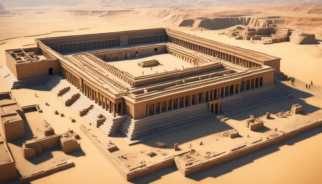
The adoption of 3D imaging and reconstruction techniques has revolutionized the field of biblical archaeology. By combining laser scanning technology with photogrammetry, researchers can create detailed, high-resolution 3D models of archaeological sites and artifacts. This groundbreaking approach offers a multitude of advantages, enabling precise measurements, virtual reconstructions, and enhanced visualization for a more comprehensive understanding of the past.
With 3D imaging, archaeologists can capture intricate details and textures that may go unnoticed in traditional 2D documentation. By digitally preserving and reconstructing artifacts and structures, researchers can analyze and manipulate the data, unlocking new insights into ancient craftsmanship, design, and architectural techniques.

Moreover, these digital reconstructions serve as invaluable tools for preservation and education. Museums and cultural institutions can display 3D replicas of important archaeological finds, providing visitors with a tangible connection to the past. Students and researchers can explore these digital models in immersive environments, enabling a more engaging and interactive learning experience.
By utilizing 3D imaging and reconstruction, we are able to delve deeper into the lives and cultures of the ancient peoples mentioned in the Bible. It offers us a unique perspective, allowing us to virtually step back in time and witness the grandeur and intricacies of these ancient civilizations.
Furthermore, the use of 3D imaging in biblical archaeology has sparked collaboration and interdisciplinary research. Archaeologists, historians, and computer scientists are working hand in hand to develop innovative software and algorithms, enhancing the accuracy and efficiency of the reconstruction process. This synergy of expertise is propelling the boundaries of knowledge and paving the way for groundbreaking discoveries.
Advantages of 3D Imaging in Biblical Archaeology
- Precise measurements for accurate analysis
- Virtual reconstructions for enhanced visualization
- Digitally preserved artifacts for long-term conservation
- Interactive learning experiences for education and outreach
- Collaboration between disciplines for innovation and progress
With the continuous advancements in 3D imaging technology, the field of biblical archaeology is poised for even greater breakthroughs. As the resolution and accuracy improve, researchers will uncover new details, unravel mysteries, and gain deeper insights into the ancient world.
Ground-Penetrating Radar and Geophysical Surveys
Ground-penetrating radar (GPR) and geophysical surveys have emerged as invaluable tools in the exploration of biblical lands. With GPR, electromagnetic waves are utilized to penetrate the ground and detect subsurface features, including buried structures and artifacts. This pioneering approach offers a non-destructive way for researchers to map the concealed layers of archaeology, providing invaluable insights into the ancient civilizations that once thrived in these regions.
In addition to GPR, geophysical surveys employ magnetometers and resistivity meters to unveil underground structures and anomalies. These surveys enhance our understanding of the landscape, uncovering hidden treasures and enlightening us about the past.
Ground-penetrating radar reveals subsurface features such as buried structures and artifacts.
Underwater Archaeology in Biblical Sites
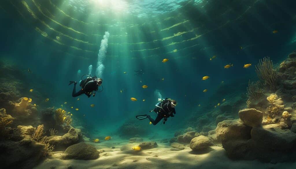
While the exploration of biblical lands often focuses on land-based sites, the field of underwater archaeology has revealed a wealth of knowledge about the maritime history and trade routes of ancient civilizations. Submerged relics, such as shipwrecks and harbor structures, offer a unique lens through which we can study the interactions and cultural exchanges of the time.
Through the use of specialized diving equipment, remote-operated vehicles (ROVs), and sonar imaging, archaeologists can dive deep into the oceans and seas to uncover hidden archaeological treasures. These cutting-edge technologies enable researchers to explore the depths and reconstruct the maritime landscapes of the past.
By studying underwater sites in biblical locations, archaeologists have gained insights into the maritime trade networks that connected ancient civilizations and facilitated the exchange of goods and ideas. These discoveries shed light on the economic, social, and cultural dynamics of the time, providing a more complete picture of the ancient world.

The Importance of Underwater Archaeology in Understanding Biblical History
Underwater archaeology plays a crucial role in understanding the history documented in biblical texts. Maritime trade was a significant aspect of ancient societies, with biblical figures, such as Solomon, renowned for their involvement in maritime trade. By exploring biblical sites underwater, researchers can uncover evidence that aligns with the accounts described in religious texts, validating historical narratives and enriching our understanding of the past.
“Exploring underwater biblical sites provides invaluable insights into the ancient maritime trade routes and the interconnectedness of civilizations in biblical times.” – Dr. Sarah Stein, Underwater Archaeologist
The Challenges of Underwater Archaeology
Underwater archaeological exploration comes with its unique set of challenges. The harsh underwater environment, limited visibility, and logistical constraints require archaeologists to rely on specialized equipment and meticulous planning. The need for conservation and preservation adds an additional layer of complexity to underwater excavations, as artifacts must be carefully documented, protected, and studied to ensure their long-term preservation.
Key Discoveries in Underwater Archaeology
Underwater archaeological expeditions in biblical sites have led to numerous remarkable discoveries that have shaped our understanding of the ancient world. Some notable findings include:
- The excavation of the ancient port city of Caesarea Maritima, providing insights into Roman engineering and construction techniques.
- The recovery of ancient shipwrecks off the coast of Dor, revealing trade routes and cargo from different periods.
- The exploration of the Sea of Galilee, uncovering remnants of fisherman’s boats and structures linked to Jesus’ ministry.
The Future of Underwater Archaeology
The field of underwater archaeology in biblical sites continues to evolve as new technologies and methodologies are developed. As advancements in underwater exploration and preservation techniques are made, we can expect even more exciting discoveries in the future. This ongoing exploration enables us to piece together the historical puzzle of biblical lands, providing a deeper understanding of the societies that once thrived in these ancient maritime landscapes.
Conclusion
Through the application of high-tech exploration techniques, biblical archaeology is continuously pushing the boundaries of knowledge and understanding. The use of remote sensing technology, 3D imaging, ground-penetrating radar, and underwater archaeology has revolutionized the ways in which we explore and interpret biblical lands.
Remote sensing technology has allowed researchers to conduct large-scale surveys of biblical lands through satellite imagery, aerial photography, and LiDAR scans. This non-invasive approach provides a comprehensive understanding of the region, without disturbing delicate artifacts. The adoption of 3D imaging and reconstruction techniques has significantly enhanced biblical archaeology, enabling precise measurements, virtual reconstructions, and enhanced visualization of ancient sites and artifacts.
Ground-penetrating radar and geophysical surveys have proven invaluable in mapping hidden archaeological layers, revealing subsurface features and offering insights into ancient civilizations. Furthermore, underwater archaeology has provided a unique perspective on maritime history and trade routes, uncovering shipwrecks and harbor structures. These advancements have shed light on ancient cultures, traditions, and historical events.
As technology continues to advance, the exploration of biblical lands will undoubtedly lead to even more intriguing discoveries and valuable insights. By harnessing the power of these high-tech techniques, researchers can continue to unlock the secrets of the past and deepen our understanding of ancient civilizations and their legacies.
FAQ
What are high-tech exploration techniques in biblical lands?
High-tech exploration techniques in biblical lands refer to the use of modern technology by archaeologists and researchers to uncover ancient mysteries. These techniques include remote sensing, 3D imaging, ground-penetrating radar, and underwater archaeology.
How does remote sensing technology contribute to biblical exploration?
Remote sensing technology plays a crucial role in biblical exploration by utilizing satellite imagery, aerial photography, and LiDAR scans. These techniques enable researchers to conduct large-scale archaeological surveys, identify potential sites of interest, and uncover hidden features of the landscape without disturbing historical artifacts.
What is the significance of 3D imaging and reconstruction in biblical archaeology?
3D imaging and reconstruction techniques have transformed the field of biblical archaeology. By combining laser scanning technology with photogrammetry, researchers can create detailed and high-resolution 3D models of archaeological sites and artifacts. This allows for precise measurements, virtual reconstructions, and enhanced visualization, providing a more comprehensive understanding of the past.
How do ground-penetrating radar and geophysical surveys aid in biblical exploration?
Ground-penetrating radar (GPR) uses electromagnetic waves to penetrate the ground and detect subsurface features, such as buried structures and artifacts. This non-destructive method allows researchers to map hidden archaeological layers and gain insights into ancient civilizations. Additionally, geophysical surveys utilizing magnetometers and resistivity meters can reveal underground structures and anomalies.
What is the significance of underwater archaeology in biblical sites?
Underwater archaeology provides valuable insights into the maritime history and trade routes of ancient civilizations in biblical lands. Through the use of specialized diving equipment, remote-operated vehicles (ROVs), and sonar imaging, archaeologists can explore the depths and uncover submerged relics such as shipwrecks and harbor structures. These discoveries offer a unique perspective on the interactions and cultural exchanges of the time.
How do high-tech exploration techniques revolutionize the exploration of biblical lands?
High-tech exploration techniques have revolutionized the exploration of biblical lands by enhancing the field of biblical archaeology. Remote sensing technology, 3D imaging, ground-penetrating radar, and underwater archaeology allow for a comprehensive understanding of the region and provide valuable insights into ancient cultures, traditions, and historical events. These advancements push the boundaries of knowledge and continue to yield intriguing discoveries.


